Utility vehicles
Identification of areas where waste collection can take place
Settlement of waste collection settlement from authorized places
Control of routes covered
Measurement of the operating time of the vehicle's engine with maximum speed control
Communicating with the driver - GarminLIVE!
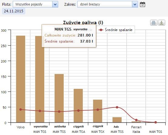
Control of average fuel consumption
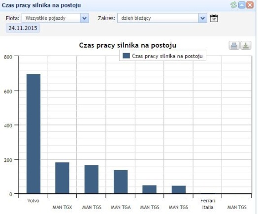
Control of work and vehicle standstill
Exact fuel diagrams (losses, refueling)
The system records the actual operating time of the machine on the basis of the engine speed, data recorded from vehicle on-board computer or external sensors, e.g. speed pulses. Hours, idling and work under load are calculated.
The route along with all parameters is monitored both in real time and recorded with the possibility of reconstruction up to six months back.
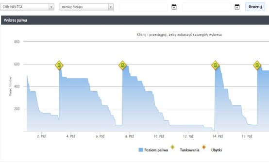
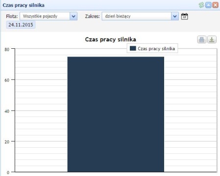
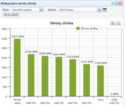
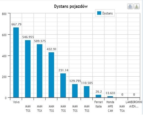
When using GPS recorders with additional signal sensors, e.g. electrical signals, enables monitoring of the operation of devices such as excavator arm or tipper body during gritting, etc. Machine data is presented in reports in the form of numerical summaries and graphs on the timeline, which greatly facilitates verification, in what time the machine worked effectively, and in what time it had exclusively an engine switched on.

A special system tool enables the creation of three types of so-called "control geo-zones": oval, multi-wall and corridors. The zones can be freely assigned to individual vehicles or groups of vehicles, so that the fleet supervisor can control the location of the vehicles in the system. different combinations. The system allows you to configure zone settings in such a way that the fleet supervisor is automatically notified by e-mail or e-mail. SMS about leaving the mandatory zone or entering the prohibited zone. The tool, in the case of the municipal vehicle fleet, intended for is to carry out surveillance when vehicles are required to be in a designated location or to travel on designated routes.
